Tropical Pond Aquaculture and Coastal Wetlands Website
Clark Labs
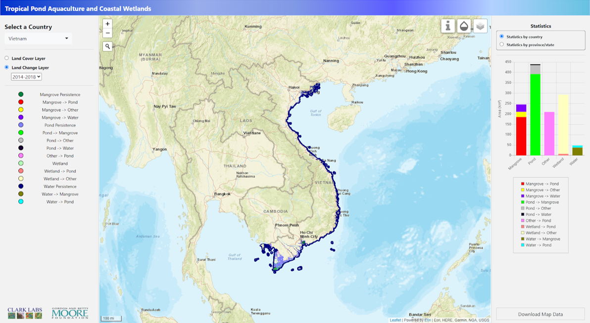
This project is mapping an inventory of pond aquaculture and coastal habitats in Bangladesh, Cambodia, Ecuador, India, Indonesia, Malaysia, Myanmar, Thailand, and Vietnam. My job in this project is to design the right panel of the website -- display the statistics with interactive charts.
Main Works
Interactive charts
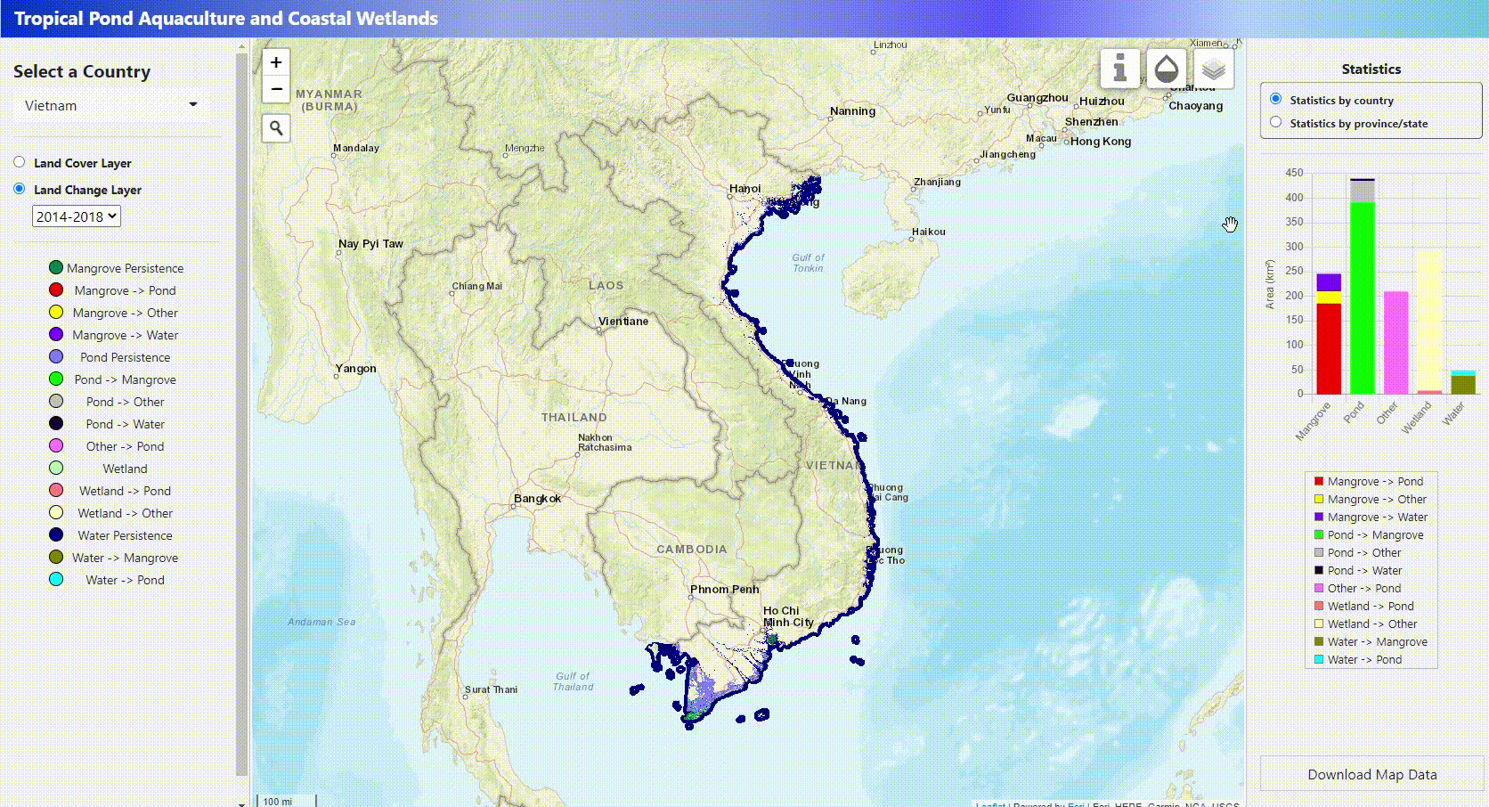
Users can interact with chart to see the landchange and landcover data. One can hover on the bar to see the classification and exact number. Also, when there are some legends which are not necessary or some legends whose values are so large that others cannot be seen, users can click the legends to hide them.
There are other useful features:
- Select specific coastal cities by dropdown box or click cities on the map
- Click layers on map to check the information
- Download map data
Data processing
The data format should be json and geojson to be stored in the server. My another work is to convert the shapefile and Excel files to geojson and json files, separately. Python code was written to automatically standarize the output. So, it is easy and efficient to update new data.
Last modified August 4, 2020